When you’ve been in the property risk management business as long as we have at Centurisk, you find some innovative ways to elevate your data collection game. And one free tool we’d like to share today that’s helped support our continued quest for more complete data is the Google Earth Pro application.
What is Google Earth Pro?
Google Earth Pro is a desktop application originally designed to let you “travel the world without ever leaving your seat.” It allows you to experience both aerial and drilled-down street views of 3D cities through your web browser. Intended for touring and map building, it lets you import and export GIS data and view locations captured across various points of their history. As our valuation experts discovered, these very features can also be extremely useful for gathering and confirming property details needed for a statement of values analysis, virtual valuation and more — particularly when travel and access to sites are limited.
How to Use Google Earth Pro for Property Risk Management
Now, we’d like to begin by saying, using Google Earth Pro is not a substitute for a professional, in-person inspection and valuation. But it does come in handy for certain too-human times, like:
- When you’ve made a note about a property and can’t read your own handwriting
- When you’ve captured a thousand property details but still need a picture of that one fence
- Or when you spy red flag data in your documentation and want to verify the work
It is also helpful when you cannot access a site, when there is no budget for travel, or during today’s current COVID-19 climate when social distancing is critical. That is where Google Earth Pro’s capabilities fit right in.
Google Earth Pro is particularly helpful for:
Capturing GPS Coordinates
Input an address into Google Earth Pro, hover your mouse over any part of the map and the GPS coordinates and elevation are right there for that area.
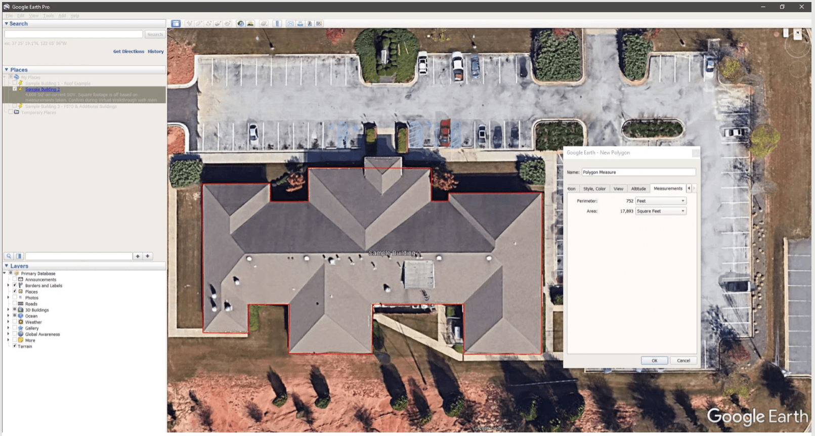
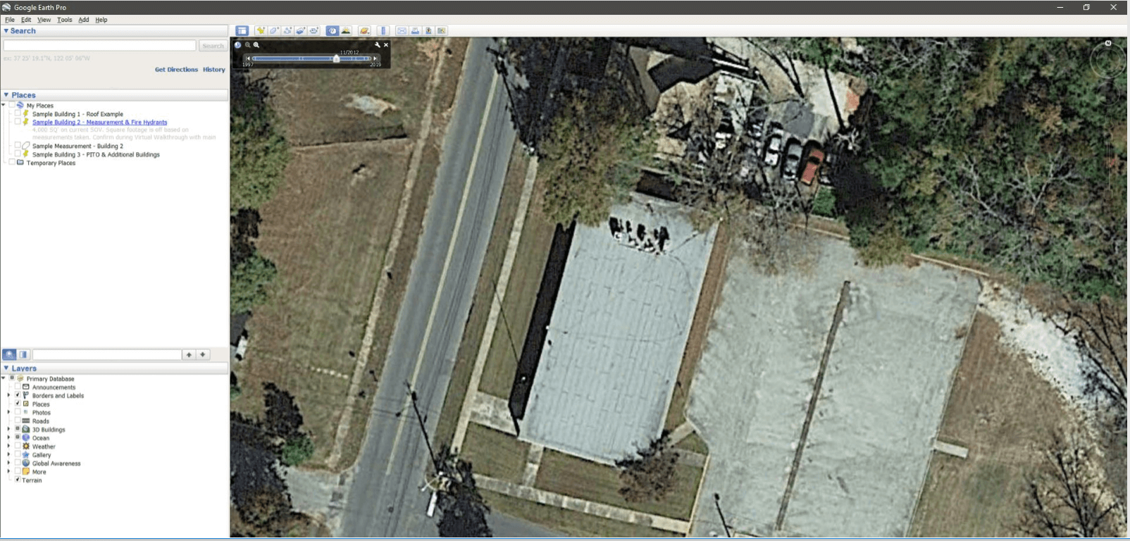
Calculating Square Footage
A nice feature of Google Earth Pro is that you can calculate the general square footage of buildings and get an accurate estimate. Simply pull up the Ruler and use the Polygon feature to draw a shape around the perimeter of any mapped structure you like, and the Measurements tab will show you the distance in feet, as well as the area of that shape. Go to a street view to verify the number of floors to calculate a full estimate for the building.
We find this feature particularly useful when we see square footages rounded to the nearest thousand or ten thousand on a customer’s Statement of Values. When we spy those, we have a sneaking suspicion the numbers are just ballpark estimates and need to verify. By providing more accurate estimates, you give insurers a greater reason to have more confidence in your data, assisting your ratings.
Calculating the Length of Fencing
The same Ruler tool that helps calculate square footage also can be used to calculate distances or the length of objects, like fencing. Choose the Path tab from the Ruler feature to follow a fence line and generate an estimate for length. For more details, visit the street view and you can gain a clearer look at the fence itself, documenting that it does, in fact, have barbed wire.

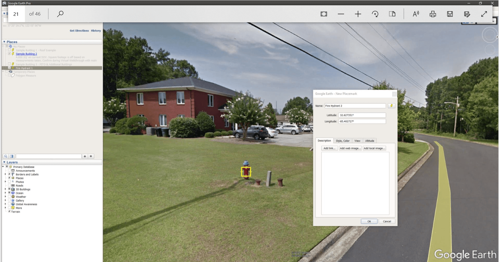
Finding the Distance to the Closest Fire Hydrant or Fire Station
When it comes to a potential fire, accessible fire hydrants and fire stations matter. Google Earth Pro lets you virtually “drive” down the local streets and pinpoint the fire hydrants and fire stations nearest to the properties you’re double-checking. Put a Placemark pin on those elements, click on the Ruler, drag it to another point (like your building!) and you can calculate the distance between those points.
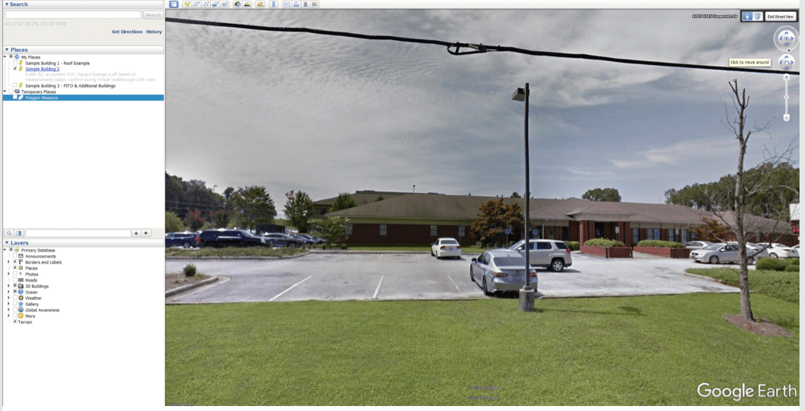
Screen Capturing Property Images
You can document both aerial and street-view images of buildings and Property in the Open for your property schedule by leveraging Google Earth Pro along with your favorite image-grabbing tool. (Our experts like Snagit.) Save the image as an asset number and upload to your property risk management system. You can fill in missing images without ever leaving your chair!
Documenting Building Details and Property in the Open
The visuals provided by Google Earth Pro are also useful when you want to quickly confirm details like roof pitch or exterior building materials on property. It’s also great if you want to document Property in the Open like light poles and signage. The quality resolution of the images gives you the detail you need to confirm the property you have. We’ve used the feature to our advantage when we’ve had structures we were unable to access during on-site inspections, such as a correctional facility, allowing us to confirm additional property and even get a rating on a generator.
Verifying That All Buildings Have Been Included
The Google Earth application’s aerial view is helpful when you want to double-check the number of buildings at a site. We’ve had instances where a customer might list two buildings on their SOV, but when we pull up Google Earth Pro we can see three more buildings before us on the application’s bird’s eye view. This enables us to document those buildings and make sure they’re accounted for, ensuring the customer gains more complete coverage.
Checking the History of Building Additions and Some Other Alterations
Now this is a very cool feature of the Google Earth Pro application, the ability to look at locations in different points over time. Here we have a property that the customer had listed on their SOV as a flat roof. But we can see below, the roof of that building is pitched.
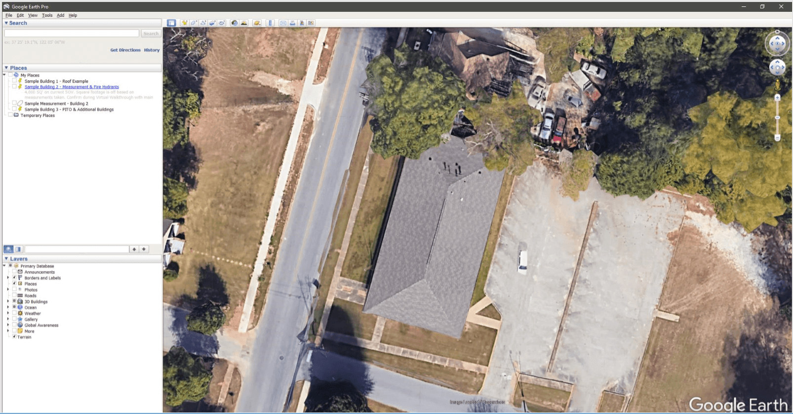
By choosing the Clock icon in the toolbar and drawing this same location back in time to 2012, we can see it was indeed flat roof and the customer just hadn’t updated the change on their SOV.
Noting for the Future
Lastly, Google Earth Pro allows you to make notes on your property sites and save those details, so you can refer back to them later. If you forget a detail, something changes, or you need to confirm a point, you can pull up the saved location and get all the data you need.
Details at Your Fingertips
With a keen eye and a little detective-work, Google Earth Pro can help support your property risk program with enhanced information and the ability to double-check data — all without ever leaving your desk.
Resources
- To download a free desktop copy of Google Earth Pro for PC, Mac or Linux, click here.
- To get a copy of the free Snagit image capture tool, click here.
And if you need help gathering these property details on-site, contact us at Centurisk. Simply fill out our form and a member of our team will be in touch!